 Cre8Travel
CRE8TRAVEL · NEW YORK PLACES
Ridge Conservation Area (Pine Barrens)
Ridge Conservation Area: Ponds, Fields and Pine Barrens Woodland
Discover
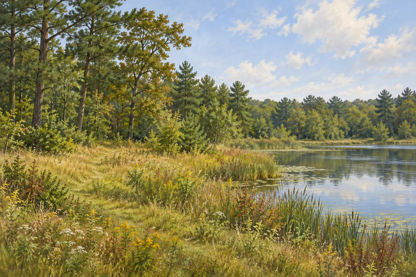
Ridge Conservation Area brings a variety of Long Island habitats into 184 acres in Brookhaven, Suffolk County. Also identified by DEC as Ridge Pine Barrens State Forest and Maintenance Center, the property combines woodland, reverting farm fields, marsh and ponds. Randall Pond gives the visit a clear starting focus, while marked routes extend the walk into different kinds of vegetation. The setting rewards a close look at the transitions between habitats as much as attention to any single destination.
The figures help explain that variety. DEC identifies 81 acres of former farm fields returning to vegetation, 85 acres of forest and four acres of ponds within the property. Those areas give a walk several different visual rhythms. Open ground allows a broader view, woodland brings trees and understory closer, and water changes the light and sense of space again. Look at where one setting gives way to another, noticing how the cover and the shape of the ground affect the scene.
Three marked routes begin near the kiosks at the southwest corner of Randall Pond. The red trail makes a 1.4-mile loop, ending on the south side of the parking area. An additional blue loop is 1.1 miles long and connects from the red route. These two choices allow the outing to have different scales. Choose the combination with the current map before setting out, leaving enough time for the habitats along the way to become part of the experience.
Yellow markers identify the accessible interpretive trail beside Randall Pond. This route extends 0.3 mile one way, with a firm crushed-stone surface, a wide tread and a gentle grade. DEC also identifies accessible viewing and fishing features from the pond parking areas, while a separate public picnic area and restroom serve the field-headquarters approach. These details make the intended starting point worth choosing carefully, according to the particular feature that suits the visit.
Interpretation adds another layer to the walk. Wooden markers along the trail connect with information about Long Island ecosystems, turning a sequence of changing habitats into an opportunity to learn. A stop beside the pond can lead to a closer look at water-associated birds, while the woodland and field margins supply different subjects. The property is on the New York Birding Trail. Give observation time, appreciating the visible habitat even when wildlife remains out of sight.
A January 2025 personal account by Travis Cutter of the Long Island Pine Barrens Society describes a guided First Day Hike here. Cutter valued the variety of grassland, ponds and pine woodland, and the chance to learn from a ranger. The account also described the striking effect of southern pine beetle damage and the presence of several dozen fellow walkers. It offers an individual memory of a particular outing, including both the appeal of the habitats and evidence of a changing forest.
Check the current DEC map, access arrangements and notices before travelling, especially the parking area serving the intended route. A short pond-side visit and a longer red-and-blue walk can each have a strong focus. Take the time to compare an opening with the tree cover beyond it, or a stretch of water with the vegetation at its edge. Ridge Conservation Area makes a varied landscape manageable at the scale of one attentive walk, with interpretation helping visitors understand the changes they can see.
Fun facts
- Ridge Conservation Area covers 184 acres in Brookhaven.
- Its habitats include reverting farm fields, forest, marsh and ponds.
- The red trail makes a 1.4-mile loop.
- The yellow interpretive trail beside Randall Pond is 0.3 mile one way.
Before you go
- Choose the parking approach for the intended pond, trail or picnic feature.
- Use the current map to decide whether to combine the red and blue routes.
- Check current DEC access arrangements and notices before travelling.
Visitor perspectives
Travis Cutter, Long Island Pine Barrens Society, January 2025: valued a guided walk through varied habitats, while finding pine beetle damage striking and walking with several dozen others. A historical personal account.
Capture
- From an appropriate public position, use the contrast between Randall Pond and surrounding vegetation.
- Compare field margins with denser woodland to illustrate the habitat variety.
- Use gentle side light to bring out the texture of tree trunks and grasses from the selected route.
 Baisley Pond Park
 Taconic Ridge State Forest
 Crocheron Park
Social
Ridge Conservation Area brings varied Pine Barrens habitats into 184 acres. #Cre8Travel
Woodland, reverting farm fields, marsh and ponds shape the walk.
Randall Pond provides a clear starting focus.
The red trail makes a 1.4-mile loop.
A blue extension adds another route choice.
Yellow markers identify the accessible interpretive trail beside the pond.
Choose the intended approach with the current DEC map and notices.
Which transition would you notice first: open field to woodland, or woodland to water?
Hashtags