 Cre8Travel
CRE8TRAVEL · NEW YORK PLACES
Skinner Hill State Forest
Skinner Hill: Former Farm Ground in a Woodland Mosaic
Discover
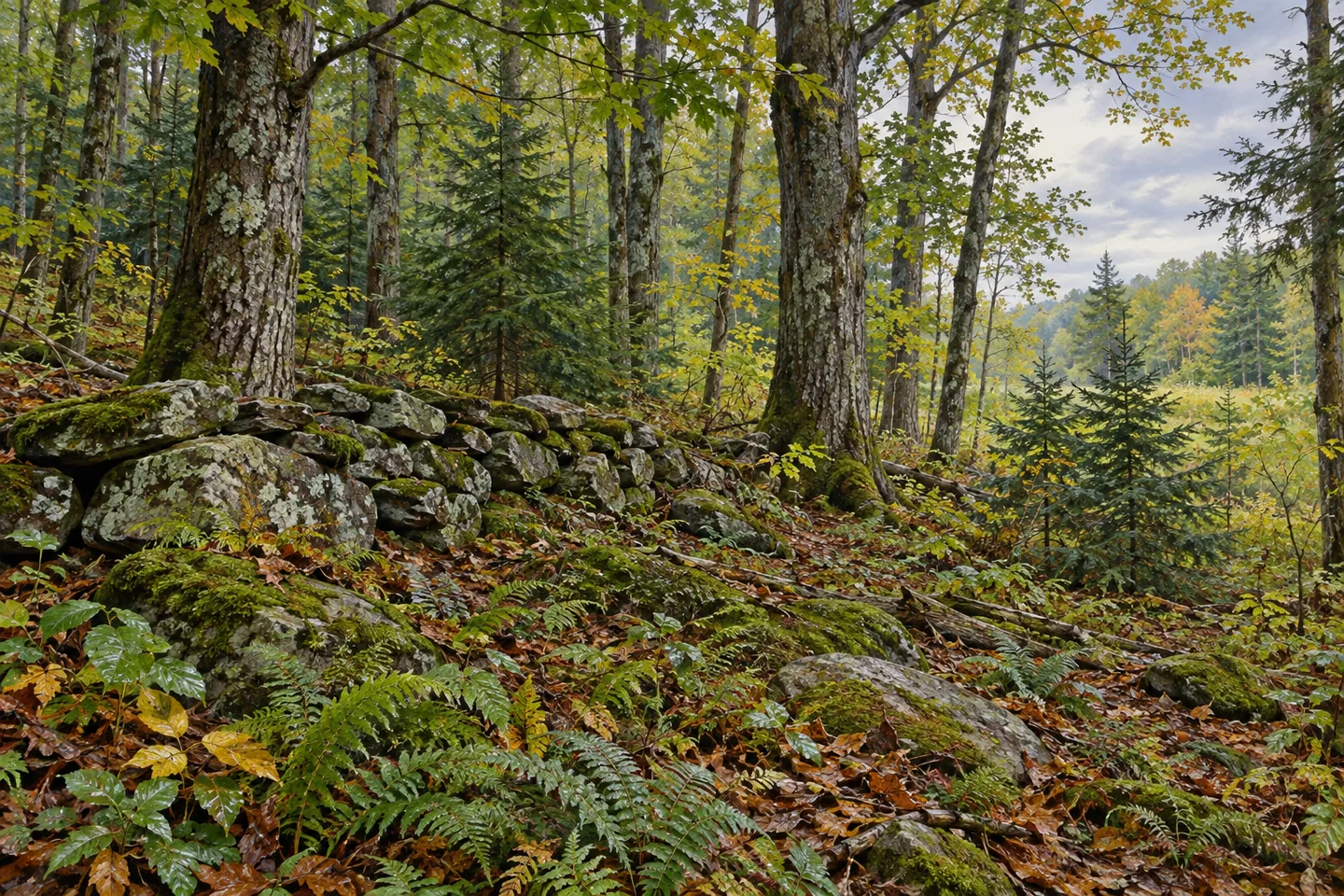
Skinner Hill State Forest has an elongated shape and a varied interior. Its 1,666 acres extend through the Chenango County towns of Sherburne, Columbus and New Berlin. Naturally established hardwoods, planted spruce and pine, open fields and wet ground give it several different characters. The forest occupies former agricultural land associated with the Skinner family, whose name remains attached to a landscape that now supports a much wider mixture of vegetation.
That farming connection provides a useful way to approach the place. A field returning to trees and a planted conifer stand represent different paths toward woodland cover. Where their forms are visible from suitable access, compare the arrangement of trees with the more irregular structure nearby. The contrast is worth noticing without assigning a planting date or an earlier crop to a particular patch of ground. The forest's name supplies context, not a complete map of its past.
Stone walls, old stone bridges and foundations are among the documented remnants across the property. They place the woodland in a landscape that carried earlier buildings, boundaries and routes. Their presence invites attention to material and setting: how stonework sits against the trees, or how vegetation has developed around it. Appreciate such remains from appropriate ground. The destination account does not identify every former structure, and a foundation should not acquire an invented history simply because it makes an intriguing photograph.
Water introduces another pattern. Two trout streams pass through Skinner Hill and join the wider drainage of Great Brook. DEC also describes small ponds and pools associated with beaver activity along these streams. These are habitat relationships rather than a promise of animals waiting beside the water. Observing changes in vegetation can be rewarding in itself, while the current map helps distinguish a stream within the property from an assumed public route along its entire course.
The spruce and pine plantations add a managed component to the natural hardwoods and wetter communities. Open fields remain part of the mix. Instead of expecting one continuous enclosed forest, consider the different forms of cover as the principal subject of an outing. A stand of conifers, a woodland edge and a damp hollow can convey how former farm ground has developed in several directions. They do not need to be linked into an invented scenic circuit to be interesting.
There are no formal trails. Old logging roads and newer skid roads provide ways through the forest, while local roads cross its elongated footprint. Two parking references are given, on Skinner Hill Road and Warren Road. Choose a particular starting point and objective with the official map. Multiple roads do not automatically create a signed loop, and their intersections should not be treated as proof that an unfamiliar woodland track returns to the chosen parking place.
An individual hiking report offers a historical perspective on that varied ground. Writing in April 2016 about a February outing, local hike leader Donald A. Windsor described being surprised by a gorge within the woodland. His account conveys the interest of the terrain, rather than establishing a current maintained route. Skinner Hill rewards that kind of close attention: former farming ground, surviving stonework, different stages of woodland and small watercourses each contribute a distinct part of the setting.
Fun facts
- Skinner Hill State Forest covers 1,666 acres in three Chenango County towns.
- The property includes farmland once worked by the Skinner family.
- Its landscape contains plantations, naturally established hardwoods, open fields and wetlands.
- Two streams passing through the forest are tributaries of Great Brook.
Before you go
- Choose one starting point and objective using the current official map, since there are no formal trails.
- Appreciate stonework from appropriate ground without climbing onto remains or entering former structures.
- Treat historical visitor routes as personal accounts rather than current marked walks.
Visitor perspectives
In a report published April 30, 2016 about a February 7 hike, Donald A. Windsor described surprise at encountering a gorge in Skinner Hill’s woodland. It is a historical personal account, not a current trail recommendation.
Capture
- Where access permits, frame ordinary stonework against surrounding woodland without assigning a building identity.
- Use differences among conifers, hardwoods and open edges as a landscape subject.
- Observe water and wetland margins from suitable ground without pursuing wildlife or leaving a chosen route for a view.
 Tracy Creek State Forest
 Beaver Creek State Forest
 Stone Hill State Forest
Social
Skinner Hill State Forest extends across 1,666 acres in Chenango County. #Cre8Travel
Its name recalls farmland worked by the Skinner family.
Natural hardwoods, planted pine and spruce, open fields and wet areas now share the property.
Stone walls, old bridges and foundations are documented traces of earlier land use.
Two streams connect the forest with the wider Great Brook drainage.
Habitat is interesting even when the animals associated with it remain out of sight.
Old logging and skid roads are different from a formal hiking network.
Choose one mapped objective and notice the landscape’s layers. Which would catch your eye first: stonework, tree cover or water?
Hashtags