 Cre8Travel
CRE8TRAVEL · NEW YORK PLACES
Schoharie Creek Preserve
Where Wilsey Creek Meets a Larger Landscape
Discover
Schoharie Creek Preserve connects woodland walking with the meeting of Wilsey Creek and Schoharie Creek. The Mohawk Hudson Land Conservancy lists a roughly 1.3-mile loop, but also warns that a significant part of the route toward and away from Schoharie Creek is steep and strenuous. That distinction should lead your planning. This is a relatively short walk whose physical demands deserve attention, rather than an easy outing simply because the distance looks compact on a map.
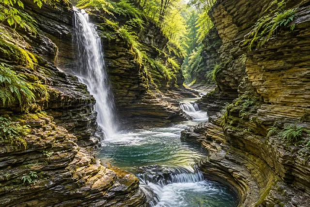
Wilsey Creek’s waterfalls are a major feature along the preserve’s northern side. The water then joins the larger creek, giving the walk a clear geographical story. Look at the relationship between the smaller channel and the wider landscape rather than treating each cascade as a separate attraction to reach at any cost. Use the operator’s current map and marked route to choose permitted viewpoints. A waterfall heard from the path is not an invitation to create an unofficial approach through a ravine.
The descent toward Schoharie Creek provides another perspective on water. The larger channel can change the scale of the scene, with woodland framing the bank and distant vegetation giving a broader context. Photograph from an appropriate place along the route and keep the return climb in mind while stopping. A view that is rewarding on the way down still leaves physical work ahead. Allow enough time and energy to complete the chosen outing comfortably rather than using the creek as the finish line.
The property was donated in 1998 by Dr. Lester Citrin and Dr. Clifford Tepper. Their wish to protect the land for public enjoyment included the views around the meeting of the creeks. Knowing that history can make the route feel less like a collection of scenic features and more like a coherent protected place. It connects the experience of looking at water with the decision that helped preserve the surrounding ground and keep a public trail available.
Earlier agricultural use adds another layer. The operator says much of the property remained cleared for farming into the 1960s and identifies old barns and equipment as reminders of that past. These are landscape-history features, not buildings or objects to enter, climb on, or handle. Notice only what is visible from authorized routes. A woodland photograph can still carry a farming history, provided the caption distinguishes the documented background from whatever physical evidence the actual view contains.
Julie’s original May 2016 account on Julie Journeys described a visit whose interest grew when Wilsey Creek and its cascades came into view. She also recorded the descent and effort of climbing back. That individual perspective is useful context for the terrain, not a current route report. Her off-trail suggestion is not adopted here. Water levels and footing change, and a past traveler’s access choice does not establish that a particular approach is appropriate or permitted today.
Check conditions and arrival information before traveling, and choose the walk for the group’s ability. Remain on marked trails, keep dogs leashed as required, and avoid crowding narrow sections or waterfall viewpoints. For a social series, combine a creek view with woodland context and a note about the preserve’s donation and agricultural past. Schoharie Creek Preserve is especially rewarding when the route’s effort and the water’s geography are considered together: a short loop that reveals how two creeks and a protected landscape fit into the same story.
Fun facts
- Dr. Lester Citrin and Dr. Clifford Tepper donated the property in 1998.
- Wilsey Creek’s waterfalls lead toward its meeting with Schoharie Creek.
- Much of the property remained cleared for farming into the 1960s.
Before you go
- Plan for the steep, strenuous creek descent and return climb.
- Use current marked routes rather than unofficial waterfall approaches.
- Check water and ground conditions before traveling.
- Treat agricultural remnants as protected features, not places to climb or enter.
Visitor perspectives
- Julie’s May 2016 original post enjoyed Wilsey Creek’s cascades and described the descent and climb back from Schoharie Creek. This historical individual account is not current route guidance; its off-trail suggestion is excluded.
Capture
- Frame water with its woodland setting from authorized viewpoints. Do not leave marked routes for a closer cascade angle or use old farm objects as staging props.
 Watkins Glen State Park
Social
Schoharie Creek Preserve follows the relationship between Wilsey Creek and Schoharie Creek.
Its roughly 1.3-mile loop includes steep and strenuous ground.
Wilsey Creek’s cascades give the smaller watercourse a strong presence.
Plan the climb back from Schoharie Creek as part of the outing.
The land was donated in 1998 for protection and public enjoyment.
Old farm remnants relate to an agricultural past that continued into the 1960s.
Use marked routes; a historical blog’s off-trail suggestion does not establish permitted access.
Save this preserve for water, woodland, and a compact route with real physical demands.
Hashtags