 Cre8Travel
CRE8TRAVEL · NEW YORK PLACES
Rocky Point Pine Barrens State Forest
Rocky Point Pine Barrens: Woodland Trails and a Communications Past
Discover
Rocky Point Pine Barrens State Forest preserves nearly 6,000 acres of pine barrens and open land in Brookhaven, Suffolk County. Its present woodland setting carries an unexpected earlier role: the Radio Corporation of America once operated a global communications center here. Changes in communications technology made that function obsolete. Today, the property offers a different kind of connection, bringing visitors into a large Long Island landscape through distinct walking, cycling and horseback-riding networks.
For walkers, route selection gives the outing its scale. DEC lists 12.2 miles of hiking trails, with the Red and Blue trails forming a 10.2-mile loop. The individual Red Trail runs 5.4 miles and the Blue Trail 4.8 miles. Those distances make the combined route a substantial walk. A portion of the Paumanok Path also crosses the property, adding a link with a longer island-wide walking tradition and a reason to notice how local routes connect beyond the forest.
A shorter experience is available from the Middle Country Road parking area. The accessible yellow trail extends half a mile one way, with a firm crushed-stone surface, a wide tread and a gentle grade. Its deliberately specified design offers a useful alternative to the longer hiking routes. Choose the feature that suits the visit, leaving time to look at the woodland's shapes and textures instead of letting the length of a larger loop determine the whole day.
The forest also has marked cycling routes and an extensive equestrian network. The separate maps matter because each activity has its own designated routes and arrangements. For a visitor on foot, that variety is part of the broader recreational character of the property, while the selected hiking route provides a clear focus. Rocky Point is also on the New York Birding Trail, giving patient observation another place in a woodland outing.
A demonstration forest adds a contemporary ecological story. After southern pine beetle was found on the property in 2015, two areas were established to study different management methods. One used a cut-and-leave approach and the other cut-and-remove, resembling a logging operation. The distinction turns management into a subject for learning: the forest is a place where researchers and land managers investigate how interventions affect woodland conditions.
DEC records the first prescribed burn in the second demonstration area in April 2021. The agency explains that prescribed fire can help maintain the pine barrens ecosystem, improve habitat and reduce accumulated fuel. This history supplies context for the managed landscape encountered today. Look at visible changes in vegetation and stand structure with curiosity, recognizing that the purpose of a demonstration area is to explore relationships between trees, habitat and management over time.
Historical visitor accounts add practical texture. In June 2025, AllTrails contributor Noell Spuhler admired Fern Valley but mentioned downed trees during a cycling experience. Other walkers described attractive pine woodland alongside navigation difficulties. These individual memories underline the value of choosing the correct map. Before travelling, check DEC's current permit process and seasonal closures, which affect recreational access. With those arrangements settled, Rocky Point offers several connected themes for an attentive visit: a communications past, a broad woodland trail network and the ongoing work of understanding a distinctive pine barrens ecosystem.
Fun facts
- Rocky Point Pine Barrens State Forest includes nearly 6,000 acres.
- RCA once used the property as a global communications center.
- The hiking Red and Blue trails combine into a 10.2-mile loop.
- The demonstration forest was established after southern pine beetle was found in 2015.
Before you go
- Use the map for the intended activity and choose a route matching the planned distance.
- Check the current DEC permit requirements and seasonal closures before travelling.
- For the shorter accessible option, consult the Middle Country Road yellow-trail details.
Visitor perspectives
Noell Spuhler, AllTrails, June 2025: admired Fern Valley during a cycling experience but reported downed trees. This historical account describes that outing rather than present trail conditions.
Lilah Quinn, AllTrails, April 2025: enjoyed a quiet pine-needle woodland walk and noted that the full loop crossed a busy road more than once. The account concerns that route and visit.
Capture
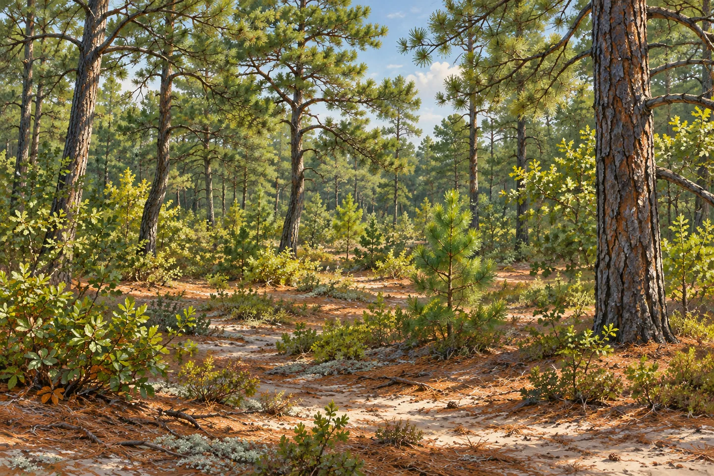
- Look for contrasts in woodland density and tree form from the selected public route.
- Use a modest foreground of pine needles and low vegetation to give a woodland composition depth.
- Use gentle side light to show the texture of needles and low vegetation beneath the trees while staying on the selected public route.
 Texas Hollow State Forest
 Hermon A MacNeil Park
 Washington Market Park
Social
Rocky Point Pine Barrens State Forest covers nearly 6,000 acres on Long Island. #Cre8Travel
Its earlier role was a global communications center operated by RCA.
Today, distinct hiking, cycling and equestrian maps organize recreational access.
The Red and Blue hiking trails combine into a 10.2-mile loop.
A half-mile one-way accessible yellow trail offers a shorter option.
A demonstration forest explores different approaches to woodland management.
Check DEC’s current permits and seasonal closures before choosing the day.
Which theme would guide your visit: woodland trails or the landscape’s changing uses?
Hashtags