 Cre8Travel
CRE8TRAVEL · NEW YORK PLACES
Poestenkill Community Forest
Poestenkill Community Forest: Old Roads and Wetland Views
Discover
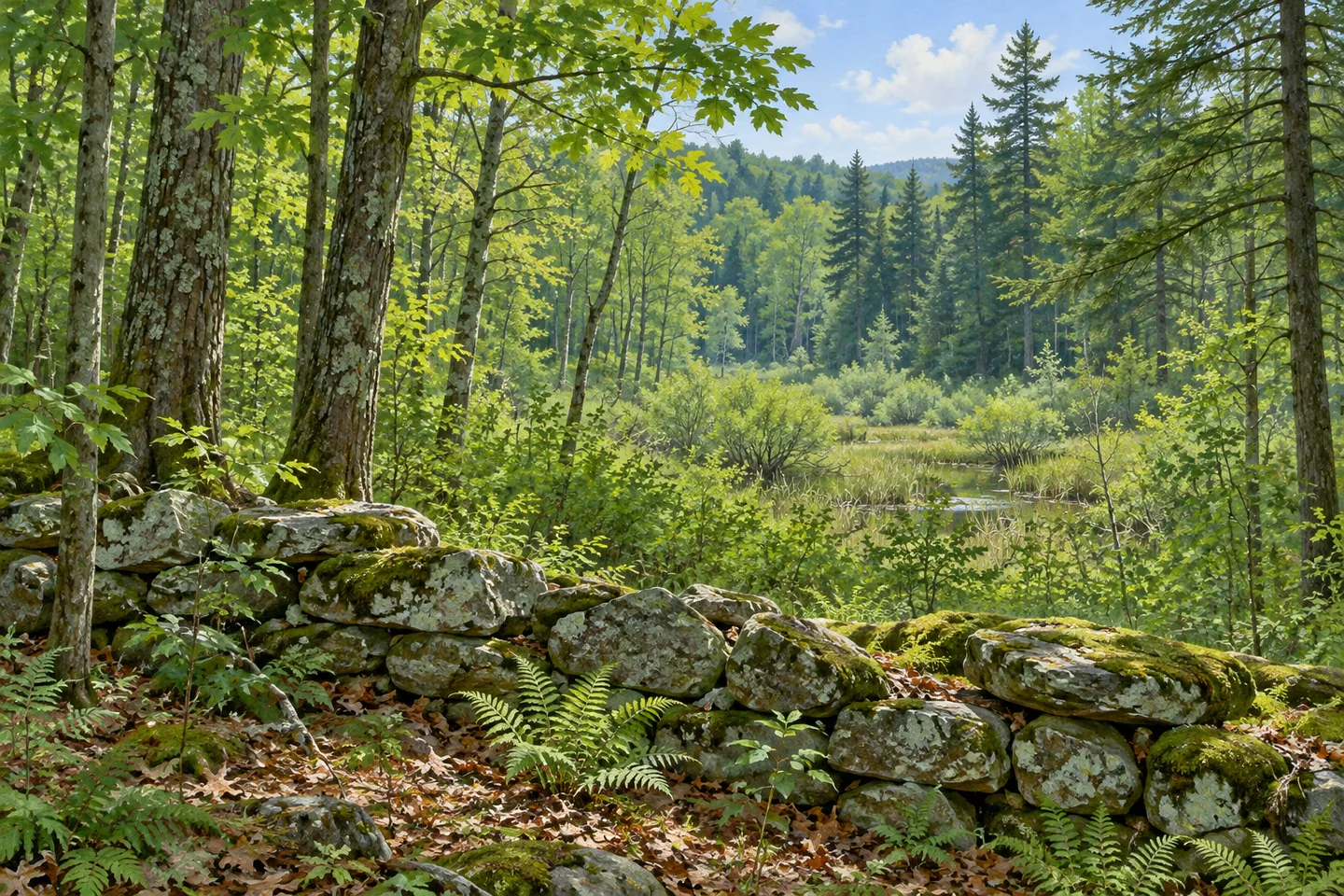
Poestenkill Community Forest brings several generations of land use into a 436 acre woodland near Averill Park. Stone walls recall former farms, old logging roads carry walking routes, and a former gravel-working area supports a younger forest. Wetlands and seasonal streams give these human traces a living setting. With more than nine miles of trails, the property offers enough variety to make the choice of route part of the visit itself, from a short wetland outing to an exploration of higher ground.
Conserved in 2014, this was the Rensselaer Plateau Alliance's first community forest. Support came through the US Forest Service Community Forest Grant Program alongside local contributors and community members. That origin gives the word community a specific meaning here: the protected land emerged from a collective effort to retain a place for outdoor recreation, learning and nature study. Today's network lets visitors approach those purposes at different distances and levels of exertion.
Dorothy's Equal Access Trail provides a compact introduction close to the entrance. Two accessible parking spaces sit across the road, and the flat trail leads approximately 600 feet to a wetland overlook. The operator describes the complete outing as just over a quarter-mile round trip. A boardwalk, bench and wheelchair-accessible picnic table give the destination several places to pause, while a Story Walk maintained by Poestenkill Library adds another reason to take time along the route. Its documented accessible design belongs to this particular trail, rather than to the entire forest network.
The wetlands are substantial features of the property. Hudson Taconic Lands describes 15 to 20 acres of forested and open wetlands, including Big Beaver Bog, within a mixture of hemlock, maple, cherry, ash, beech and other conifers. The Big Beaver Bog Trail climbs to a wetland overlook from Hemlock Swamp Trail, with a short spur approaching the wetland edge. The arrangement encourages a change in perspective: an overlook reveals the broader setting, while the woodland approach places the wetland within its surrounding forest.
Elsewhere, the trail system follows a record of work and travel. Old logging roads form its underlying framework, and remnants of the colonial-era Albany–Boston Post Road survive within the network. Stone walls mark former crop fields and pastures from an earlier period of subsistence farming. Along Moose Trail, sections of old road, stream crossings and visible walls connect those histories with the present terrain. Its listed 1.53 mile length describes a trail through the network, so plan connecting routes separately.
Gravel Ridge Road introduces a different chapter. This corridor passes a former sand and gravel mine abandoned in the mid 1970s. The operator points out the younger, developing forest here in comparison with the older woods around it. Looking for that contrast gives an apparently ordinary stretch of trees a particular story: forest recovery has followed a recent industrial use of the ground, alongside much older agricultural and travel routes elsewhere on the property.
Use the official map to choose which of these landscapes to connect from the entrance at 200 Legenbauer Road. Upper portions of the community forest involve significant elevation gain, while individual trails have distinct lengths and surfaces. A short visit centered on Dorothy's Trail can be complete in itself. A longer walk can follow the transition from wetland to wooded ridge, with old walls and roads giving continuity to a forest still changing around them.
Fun facts
- The 436 acre property became the Rensselaer Plateau Alliance’s first community forest in 2014.
- The trail network includes remnants of the Albany–Boston Post Road.
- Dorothy’s Equal Access Trail is approximately a quarter-mile round trip.
- A former gravel mine abandoned in the mid 1970s now supports developing forest.
Before you go
- Use the official map to select a connected route through the network.
- Dorothy’s accessible trail is distinct from the higher, uneven forest trails.
- Treat the listed 1.53 mile Moose Trail as one route segment, not a complete loop.
Capture
- Frame a documented stone wall with the surrounding woodland.
- Use the wetland overlook to compose a broad landscape without leaving the trail.
- Compare younger woodland along Gravel Ridge Road with the surrounding older forest.
 RBTL West Herr Auditorium Theatre
 Robert Ingalls Preserve
 Saugerties Lighthouse
Social
Poestenkill Community Forest combines 436 acres of woodland, wetlands and traces of earlier land use. #Cre8Travel
Conserved in 2014, this was the Rensselaer Plateau Alliance’s first community forest. #Cre8Travel
Dorothy’s Equal Access Trail offers a short round trip to a wetland overlook. #Cre8Travel
Stone walls reveal former crop fields and pastures within today’s forest. #Cre8Travel
Remnants of the Albany–Boston Post Road belong to the trail network’s layered history. #Cre8Travel
Big Beaver Bog is part of the property’s 15 to 20 acres of forested and open wetlands. #Cre8Travel
Gravel Ridge Road passes a former mine where younger forest has developed. #Cre8Travel
Choose a route with the official map: upper trails and Dorothy’s short accessible outing differ substantially. #Cre8Travel
Hashtags