 Cre8Travel
CRE8TRAVEL · NEW YORK PLACES
Mount Pleasant State Forest
Mount Pleasant State Forest: Following the Overland Trail
Discover
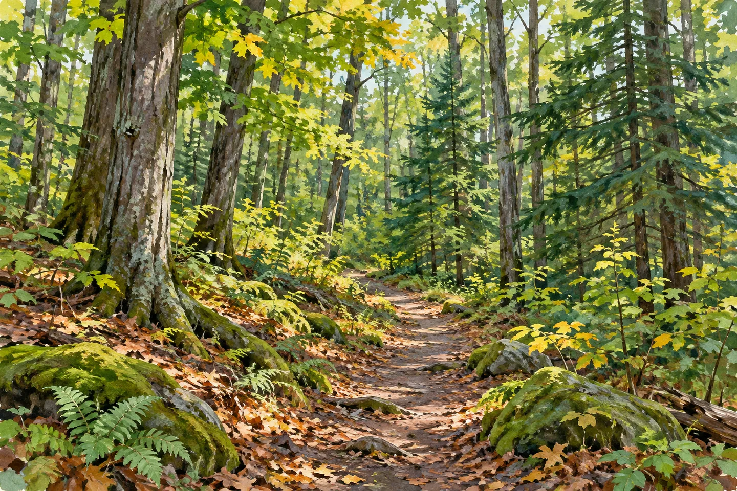
Mount Pleasant State Forest offers a useful way to connect a walk with the story of a managed woodland. Its 1,522 acres lie in Chautauqua and Sherman, Chautauqua County. A 4.8-mile section of the Fred J. Cusimano Westside Overland Trail crosses the property, weaving among woodlots and access routes. The county Parks Department maintains this section, giving a visit a named corridor to follow through a larger forest.
For that trail, DEC lists hiking, biking, snowshoeing and cross-country skiing. Horses and motor vehicles are excluded from the Overland corridor. Activity permissions elsewhere on the property need to be considered separately, especially where routes meet. Check the current map and rules for your chosen activity rather than assuming that every forest road and trail has the same use conditions.
The 1930s provide a clear historical starting point. Civilian Conservation Corps projects here included road construction and the planting of thousands of pine and spruce trees in open areas. Much of the planted ground had been farm fields. The present woodland therefore reflects both earlier land use and deliberate planting, rather than a simple story of forest that has never changed.
DEC's timber-management account explains what happened after planting. Partial harvests create light openings that encourage native hardwood regeneration in conifer stands. A later removal of the overstory allows seedlings to develop. Hardwoods also regenerate naturally, with periodic thinning giving remaining trees more growing space. These methods help explain differences between stands without implying that every proposed operation is currently underway or every management objective has already been met.
The agency also describes mechanical harvesters used with forwarding equipment. Logs can be lifted and carried to a landing rather than dragged across the ground. DEC discusses those techniques as ways to reduce soil and residual-tree impacts. Reduced impact does not mean the soil remains completely undisturbed, an important distinction when looking at a working forest. Management is part of the landscape's character, not an invisible process outside the visitor experience.
Some large hardwood stands can suggest old growth even though they were harvested before state ownership. Their size is worth noticing, but does not establish an untouched past. Try comparing larger trunks, conifer forms and younger woodland cover as a photographic sequence. The visual differences can carry the story without relying on a promised animal encounter or an unsupported ancient-forest description.
Deer, ruffed grouse, rabbit, bear and turkey appear in DEC's wildlife account. Think of them as context for varied habitat, rather than a sightings checklist. The Chautauqua Unit Management Plan provides the broader framework for the property, while the trail offers a practical way to keep a day’s visit focused on one part of it.
The retained access description identifies a northern parking approach on Route 430 west of Mayville and a southern approach near Mount Pleasant Road and Titus Road. Check the current official map and access guidance before departure; the existence of two approaches does not guarantee available spaces. Follow Leave No Trace and appropriate outdoor-safety practices. Mount Pleasant's most distinctive thread is straightforward: a county-maintained Overland Trail section through a forest whose planting, harvesting and regeneration all belong to its history.
Fun facts
- Mount Pleasant State Forest covers 1,522 acres in Chautauqua and Sherman.
- The county maintains 4.8 miles of the Fred J. Cusimano Westside Overland Trail within the forest.
- CCC projects in the 1930s included road construction and pine and spruce plantings.
- DEC describes timber harvesting with mechanical harvesters and forwarding equipment.
- Some large hardwood stands were harvested before state ownership, despite an old-growth appearance.
Before you go
- Consult the current map for the Overland Trail and its activity-specific restrictions.
- Keep horse and motor-vehicle use separate from the Overland corridor’s allowed activities.
- Check current access for the northern Route 430 and southern Mount Pleasant Road/Titus Road approaches.
- Use woodland structure as an observation focus without expecting particular wildlife.
- Follow Leave No Trace and DEC outdoor-safety guidance.
Capture
- Use an accessible part of the Overland Trail as a leading line among woodland forms.
- Compare conifer shapes with younger hardwood growth without claiming a particular individual tree dates to the CCC era.
- Make a close study of bark and canopy texture when the available light interests you; no special visiting time is implied.
 Kabob Wildlife Management Area
 Panama State Forest
 Whalen Memorial State Forest
Social
Mount Pleasant State Forest covers 1,522 acres in Chautauqua and Sherman. A 4.8-mile Overland Trail section gives a woodland visit a clear route focus. #Cre8Travel
The Fred J. Cusimano Westside Overland Trail at Mount Pleasant permits hiking, biking, snowshoeing and cross-country skiing; horses and motor vehicles are excluded. #Cre8Travel
CCC work at Mount Pleasant in the 1930s included roads and thousands of pine and spruce plantings. Former farm fields are part of the forest’s story. #Cre8Travel
DEC describes partial harvests and natural hardwood regeneration in Mount Pleasant’s conifer stands. Timber management belongs to the landscape’s history. #Cre8Travel
Mechanical harvesters and forwarding equipment feature in Mount Pleasant’s management account. Reducing soil impact does not mean leaving soil completely undisturbed. #Cre8Travel
Large trees at Mount Pleasant do not automatically establish old growth: some stands were harvested before state ownership. Look closely at structure and history. #Cre8Travel
Check the current map for Mount Pleasant’s northern Route 430 and southern road approaches before a visit. A parking location is not a promise of spare spaces. #Cre8Travel
At Mount Pleasant, compare conifer forms and younger hardwoods through a series of photographs. Which woodland detail would best tell the story? #Cre8Travel
Hashtags