 Cre8Travel
CRE8TRAVEL · NEW YORK PLACES
Crary Mills State Forest
Crary Mills: Three Parcels and a Planted-Forest History
Discover
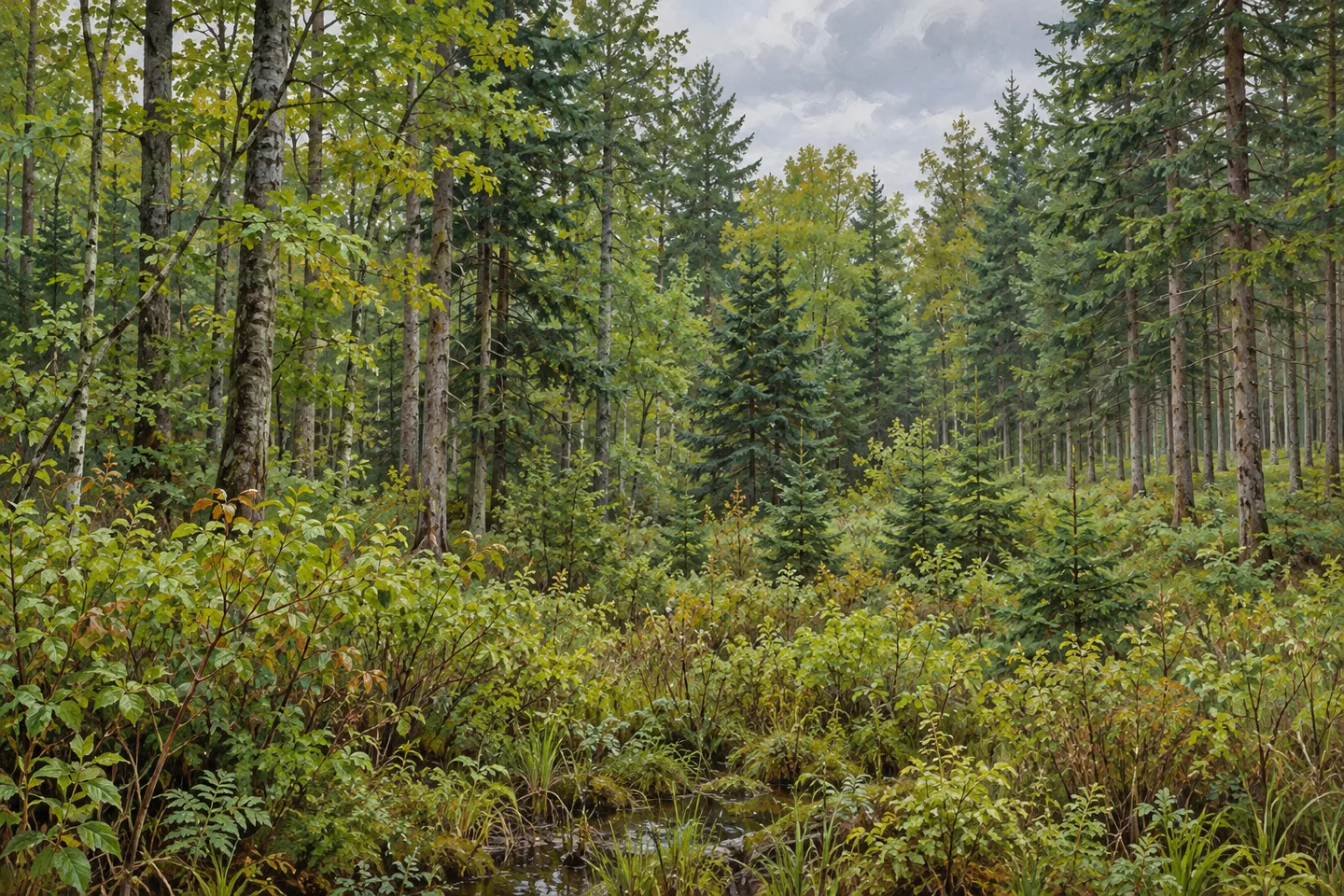
Crary Mills State Forest presents a varied woodland setting in the Town of Potsdam, St. Lawrence County. Its 587 acres are divided among three parcels, rather than forming one continuous block with a single central attraction. That arrangement is worth understanding before a visit. The interest lies in how different ground supports different vegetation, and in the history of planting and management that helped turn former agricultural land into public forest.
The state purchased the parcels in 1962 and 1963 for several connected purposes: reforestation, wildlife management, timber production, recreation and watershed protection. These dates place Crary Mills in a later period than the 1930s acquisitions associated with many New York state forests. Its story is specific to a property assembled in the early 1960s, followed by a substantial program of planting on ground that had once been fields and pastures.
More than 199,000 trees were planted across 210 acres between 1963 and 1972. The planting included white and Scotch pines, white spruce and larch, along with an experimental planting of lodgepole pine. That list makes the forest's history more varied than a simple replacement of open fields with one tree species. Where planted stands can be recognized from an appropriate route, their arrangement offers a way to think about the choices made during that period without assigning every tree an exact planting date.
The property's uplands support a mixture of northern hardwoods, hemlock and white pine. Flatter areas have open wetlands and shrub swamps, grading into swamp hardwoods and white cedar where flooding is seasonal. This creates a useful contrast between higher and lower ground. The visitor does not need to enter wetland vegetation to appreciate the distinction; observe what is visible from a suitable position and keep the relationship between landform and tree cover in mind.
Management continued after the initial planting. In 2008, several plantations received their first improvement thinning, which removed diseased or poorly formed trees and reduced crowding. That dated episode provides a concrete example of managed forest history. It should not be treated as a current work notice or a claim that every stand was thinned at the same time. Instead, it explains why establishment and later care both belong to the story of these woods.
There are two short access trails, associated with Leary Road and Parmenter Road. Hiking is also permitted through the forest, but the published description does not turn those short approaches into a connected, signed circuit across all three parcels. Select a starting point with the current official map and a realistic route in mind. The presence of separate road accesses is useful information, rather than a reason to assume the whole property can be explored by one straightforward loop.
Crary Mills combines planted woodland, naturally developing forest and wetter ground within a relatively small public holding. Its most rewarding theme is that mixture: land once used for agriculture now carrying several kinds of trees and habitats, with a documented history of active care. A modest walk can focus on those differences without seeking a named overlook or a major landmark. Keeping the parcels, routes and woodland histories distinct gives the place a clearer identity.
Fun facts
- Crary Mills covers 587 acres in three parcels purchased in 1962 and 1963.
- Over 199,000 trees were planted on 210 acres between 1963 and 1972.
- The planting program included an experimental stand of lodgepole pine.
- Several plantations received their first improvement thinning in 2008.
Before you go
- Use the current map to choose between the Leary Road and Parmenter Road access references.
- Do not assume the two short trails connect all three parcels into a signed circuit.
- Observe wetland and planted-stand differences from appropriate ground without entering sensitive vegetation.
Capture
- Compare visible planted-stand patterns with mixed woodland without assigning an unsupported date to individual trees.
- Look for contrasts between upland tree cover and wetter vegetation where these are visible from legitimate access.
- Keep illustrations general rather than claiming an exact plantation layout or route.
 Colgate Lake Wild Forest
 Crystal Lake Wild Forest
 Daketown State Forest
Social
Crary Mills State Forest has 587 acres across three parcels in Potsdam. #Cre8Travel
The state acquired the parcels in 1962 and 1963, followed by years of planting.
Over 199,000 trees were planted on 210 acres between 1963 and 1972.
An experimental lodgepole pine planting adds a distinctive detail to the forest history.
Upland hardwoods, hemlock and white pine contrast with wetter areas and shrub swamps.
A documented 2008 thinning shows how management continued after the planting years.
Leary Road and Parmenter Road have short access trails; that does not establish a loop across all parcels.
Look at how different kinds of woodland relate to the ground beneath them. Crary Mills is a compact place with several forest histories.
Hashtags