 Cre8Travel
CRE8TRAVEL · NEW YORK PLACES
Blue Mountain Wild Forest
Blue Mountain Wild Forest: Five Tracts and Several Ways to Read the Land
Discover
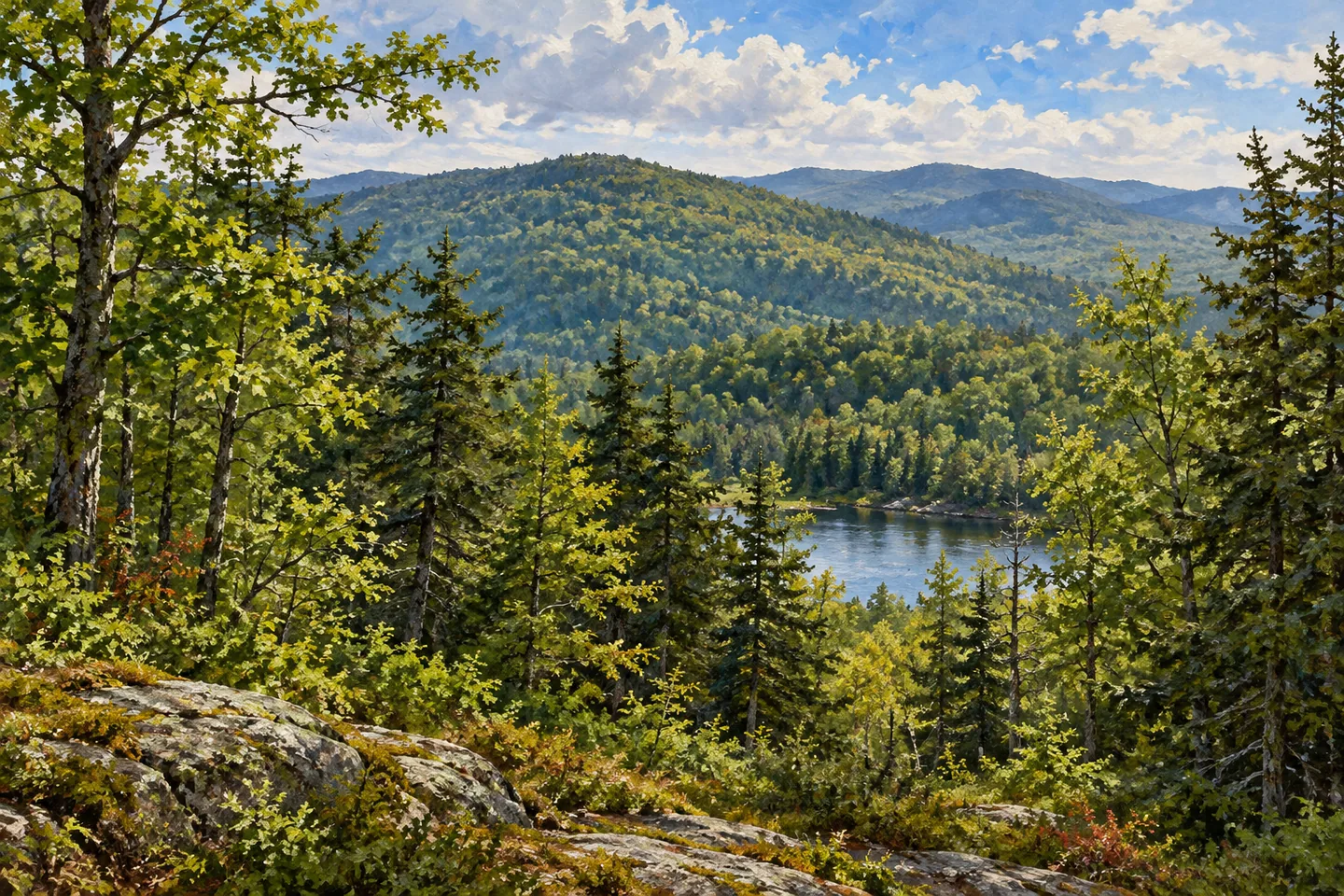
Blue Mountain Wild Forest is not a single block of land organized around one entrance. Its 37,800 acres comprise five separate tracts in the central Adirondacks, between Indian Lake, Blue Mountain Lake, Long Lake and Newcomb. That arrangement gives it several possible starting points and markedly different settings. A visit might focus on a mountain approach, a pond or a section of a longer trail, but it needs to begin with the particular parcel and route rather than the forest name alone.
The terrain varies substantially across the unit. Rock Lake occupies a gentler setting, while the remote Fishing Brook Range is steep and rugged. Blue Mountain is the most prominent named mountain in the surrounding landscape. These differences make a general description such as a woodland walk incomplete: the forest contains settings with different demands, distances and ways of approaching the ground. Selecting a destination also means choosing which part of that varied terrain belongs to the outing.
One connecting thread is the Northville-Placid Trail, which traverses 15.2 miles through the wild forest. Much of that section lies between the approach near Lake Durant on Route 28/30 and the northern trailhead on Route 28 N. It passes the foot of Blue Mountain and the shore of Tirrell Pond, while also climbing over the shoulder of an unnamed mountain. The route's relationship with several landscape features gives it a different character from a direct summit approach.
The Blue Mountain Trail provides that more focused mountain outing. DEC describes a 2.2-mile climb from its trailhead with 1,550 feet of ascent. The rocky summit offers partial views in several directions and also contains a fire tower. Those details establish a destination and a substantial change in elevation; they do not make the route an effortless extension of a drive through the area. Choose the trail as a specific undertaking rather than assuming all forest access points provide similar walking.
The wider information includes private conservation easement land as well. On the Township 19 Tract, the 1,400-acre public-use area lies south of O'Neill Flow Road. On the Township 20 Tract, the 1,081-acre public-use area is west of Minerva Club Road and Six Mile Brook. Public rights elsewhere on those tracts are restricted to specifically permitted corridors and activities. The distinction is essential: a conservation easement protects land while defining public opportunities, without turning every nearby parcel into unrestricted state forest.
These working forests may also have access affected by timber operations. Roads or gates cannot be interpreted independently of their permitted uses. On Blue Mountain itself, the access road serving radio towers is private and is not an alternative public approach. Following a documented trail and understanding its starting point is more useful than treating every road on a map as a visitor option. The forest's separated tracts make that attention especially important.
For an observation-centered visit, connect one chosen route with the larger landscape it reveals. Tirrell Pond, a mountain shoulder and a summit approach each offer a different way of noticing the relationship between water and wooded ground. There is no need to combine every feature into one itinerary. Blue Mountain Wild Forest becomes clearer when its individual places remain distinct, with the public trail, the private easement and the wider Adirondack setting each understood at the appropriate scale.
Fun facts
- The 37,800-acre wild forest consists of five separate tracts.
- The Northville-Placid Trail traverses 15.2 miles within the wild forest.
- The Blue Mountain Trail climbs 1,550 feet over 2.2 miles from the trailhead.
- Township 19 andTownship 20 public-use areas occupy specified portions of privately owned easement land.
Before you go
- Choose the particular tract, trailhead and route together.
- Respect the boundaries of the Township 19 andTownship 20 public-use areas.
- Do not use the private radio-tower access road on Blue Mountain as a public approach.
Capture
- From a documented viewpoint, relate wooded slopes and distant water without promising a clear panorama.
- Use a pond-side composition only from the legitimate public route, without inventing shoreline access.
- Keep a conceptual image general rather than reconstructing an exact fire tower, summit or trail junction.
 Black River Wild Forest
 Bluestone Wild Forest
 Delphi Falls Park
Social
Blue Mountain Wild Forest consists of five separate tracts in the central Adirondacks. #Cre8Travel
Its 37,800 acres contain different settings, from gentler Rock Lake terrain to the rugged Fishing Brook Range.
The Northville-Placid Trail traverses 15.2 miles within the wild forest and passes Tirrell Pond.
The Blue Mountain summit route is a specific mountain outing:2.2 miles with 1,550 feet of ascent.
Private conservation easements provide additional opportunities only within defined public-use areas and permitted corridors.
Township 19 public use is scoped south of O’Neill Flow Road; Township 20 has its own boundary west of Minerva Club Road and Six Mile Brook.
The road serving Blue Mountain’s radio towers is private, not an alternative visitor trail.
Choose one route and understand its ground. A forest with several tracts does not need to become a single overloaded itinerary.
Hashtags