 Cre8Travel
CRE8TRAVEL · MAINE PLACES
Sheepscot Historic District
Sheepscot Historic District: A River Village in Context
Discover
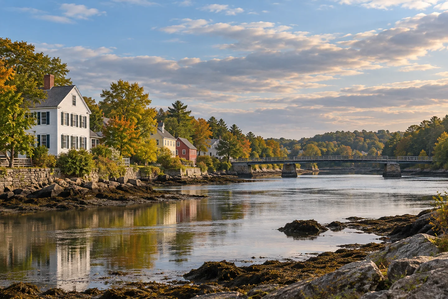
Sheepscot village offers a quieter way to understand a Maine river settlement. The historic district brings together architecture, a crossing and the record of a community that developed beside the Sheepscot River. The National Register recognizes both architectural and archaeological significance, with Federal, Greek Revival and Italianate styles among its listed features. For a visitor, the sensible focus is the publicly visible village landscape. Historic importance does not turn private land or archaeological locations into places to explore on foot.
Newcastle's comprehensive plan explains how river passage and the arrangement of homes shaped Sheepscot. Coastal stagecoach traffic once crossed by ferry and later used the Free Bridge, erected in 1794. The plan also describes the relationship between clustered home lots and more distant land used for cultivation or woodlots. That pattern supplies a useful way to look at the village: houses, open ground and routes of travel belong to the same story. The plan identifies longstanding gathering places including the grange and two community church buildings. Look for the collective pattern rather than trying to treat every structure as a separate attraction with visitor services.
The river adds natural context to that human geography. A U.S. Fish and Wildlife Service watershed description places the Sheepscot's upper estuary near Alna and identifies the Dyer River as an important tributary. It describes ledge at Sheepscot Falls and a wider landscape shaped by glacial deposits and changing land use. These features explain why a village view can contain several kinds of terrain within a relatively small area. The tidal river is also a reminder that a settlement connected to the coast does not need an open-ocean shoreline to have a maritime setting. Observe from authorized public positions; this is context for looking, not a recommendation to enter the river or search for a route along its banks.
Sheepscot also has a more recent story of people making a place for community life. Newcastle's current account of the Harriet Gertrude Bird Clubhouse describes a six-acre property in the heart of the village, built by Pauline Fenno in honor of her neighbor and donated to the town in 1975. Over time it has accommodated educational activities, local gatherings, celebrations and recreation. The details matter because they prevent the historic district from seeming like an uninhabited architectural display. People have continued to invest in shared spaces here, just as earlier residents needed places to meet. Any indoor use of the clubhouse follows the town's separate arrangements.
A thoughtful visit can be simple: choose a short public route, notice how buildings relate to the crossing and open ground, and stop where you can look without obstructing traffic or access. For photographs, try a broad composition that includes more than one element of the village, followed by a close architectural detail visible from the public way. Leave gardens, church interiors and private commons alone unless access is explicitly provided. Sheepscot's appeal lies in seeing a community as a connected landscape—built, natural and still lived in—rather than collecting a larger number of stops.
Fun facts
- The district entered the National Register in 1978.
- Newcastle’s plan dates the historic Free Bridge to 1794.
- Pauline Fenno’s clubhouse gift to the town dates to 1975.
Before you go
- Keep the visit to public ways and explicitly authorized spaces.
- Treat church interiors and clubhouse use as separate arrangements.
- Do not search private riverbanks or archaeological locations for access.
Capture
- Compose a view that relates the village’s buildings to the river setting from an authorized position.
- Pick an exterior detail visible from the public way without entering gardens or doorsteps.
 Rockport Historic District
 Spectacle Island Preserve, Sheepscot River
 Abyssinian Meeting House
Social
Sheepscot’s historic village combines architecture with river geography.
Its National Register recognition includes archaeological significance as well as buildings.
A ferry crossing preceded the Free Bridge described in Newcastle’s historical plan.
Clustered home lots and more distant working land help explain the village pattern.
The river setting belongs to a larger estuary and watershed.
A 1975 gift created a lasting place for community gatherings.
Keep private spaces private while appreciating the public village scene.
When you explore a historic village, do you begin with its buildings or its landscape? #Cre8Travel
Hashtags