 Cre8Travel
CRE8TRAVEL · MAINE PLACES
Pleasant Lake, Stetson
Pleasant Lake, Stetson: Follow the Water to the Marshes
Discover
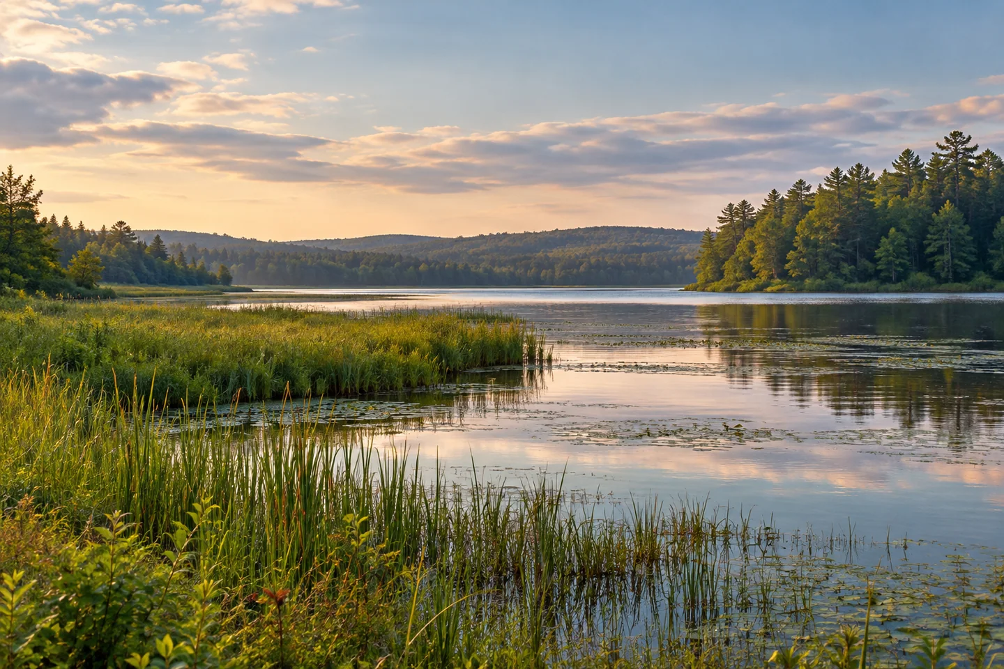
Pleasant Lake in Stetson is a place to watch the boundary between open water and wetland change shape. A paddle can begin in a winding outlet channel before the broader lake comes into view, with wooded margins and low marshes giving the journey a close, textured foreground. Put Stetson into the map search: Maine has several Pleasant Lakes and Ponds, and this one belongs to the Sebasticook watershed in Penobscot County.
The outlet-dam launch gives the water outing its starting point. Sebasticook Regional Land Trust confirms that this landing was donated to the town by Kent Hewitt and can be used to reach the lake and the preserve by boat. Organize gear before occupying the launching space and confirm current local parking arrangements. With the access established, choose a route that fits the day's wind rather than assuming the whole lake needs to be explored in one visit.
The fishery tells a different story from a cold, deep mountain lake. A state survey revised in 1997 describes a shallow waterbody suited to warmwater fish, including smallmouth and largemouth bass and white perch. It records the introduction of smallmouth in 1960 and the arrival of other species from downstream Sebasticook Lake. Those dated observations help explain the lake's connections and management history. Anglers still need contemporary rules and local knowledge rather than treating an old survey as a current catch report.
Stetson Stream carries water onward toward Sebasticook Lake. Seen through that relationship, the outlet is more than a convenient place to launch: it is one link in a larger drainage system. A watershed plan identifies the connected stream-and-lake area as important waterfowl and wading-bird habitat. A pause beside the marsh can therefore be worthwhile even when no striking animal appears. Notice how vegetation, sheltered water and open reaches sit together, while giving wildlife enough room to continue its ordinary activity.
Michael Perry's June 2024 Portland Press Herald canoeing column describes a personal exploration of the western lake. He enjoyed the channel and marsh-side scenery, then changed plans when a northerly wind increased, leaving the eastern end for another visit. That adjustment is as useful as any scenic detail in the account. A satisfying paddle can keep something in reserve. His reported trip length and June observations belong to that outing, rather than a timetable or seasonal promise for another visitor.
The wooded peninsula known as the Cape offers a recognizable landmark from the water. Preserve landing places and picnic facilities are described by the land trust; use only established, permitted sites if adding a shore break. A water visit can remain distinct from a full woodland-trail outing. Keep the lake's changing shoreline in view, with a short stop chosen for the group instead of automatically adding every available walking route.
For photographs, try a modest band of open water between a close wetland edge and the farther woods. Another frame can emphasize the channel's bend rather than its destination. Choose a return time that lets the shore visit finish without rushing the final photographs. Return with enough time to load without blocking others. Pleasant Lake suits this unhurried approach: a public water entry, a warmwater fisheries story and a marsh-lined connection to the wider watershed.
Fun facts
- Stetson Stream connects this Pleasant Lake with downstream Sebasticook Lake.
- The outlet-dam boat launch was donated to the town by Kent Hewitt.
- A historical fisheries survey describes warmwater habitat and a 1960 smallmouth introduction.
Before you go
- Use Stetson in navigation and fishing-rule searches to resolve the correct Pleasant Lake.
- Prepare equipment clear of the outlet launch so others can use it.
- Reassess wind before committing to the broader lake.
- Use the preserve’s established permitted landing places for any shore break.
- Observe marsh birds from a distance rather than approaching nests or flocks.
Visitor perspectives
- Michael Perry’s June 2024 canoe account enjoyed western marsh scenery, shortening the trip when a northerly wind increased.
Capture
- From a stable permitted position, place wetland vegetation in front of a band of open lake.
- Photograph the line of a channel bend, keeping the craft’s navigation the priority.
 Upper Shin Pond
 Baker Lake
 Big Machias Lake
Social
Pleasant Lake in Stetson invites attention to channels, marshes and open water.
Begin at the verified town launch by the outlet dam and confirm local parking arrangements.
This is a warmwater fisheries landscape, with a history different from Maine’s deep mountain lakes.
Water continues through Stetson Stream toward Sebasticook Lake.
The connected wetland area has a place in the wider watershed’s bird habitat.
A 2024 canoeing account changed course when wind built. Saving the eastern lake for another trip was part of the day.
A permitted shore break can complement a paddle without turning it into a full woodland itinerary.
Would you rather photograph the open lake or a winding channel through its wetland edge?
Hashtags