 Cre8Travel
CRE8TRAVEL · MAINE PLACES
Gulf Island Pond
Gulf Island Pond: A River with Room to Wander
Discover
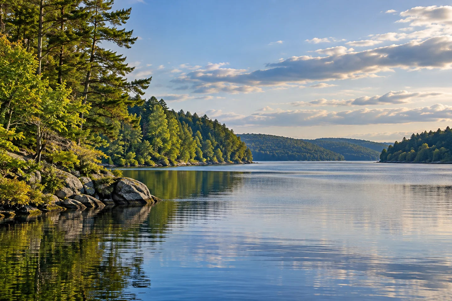
Gulf Island Pond is an invitation to read a river differently. This impoundment on the Androscoggin holds stretches of broad, lake-like water, yet its long shape still carries the direction of the river through the landscape. Plan an outing around a public launch and a manageable return rather than imagining a single open-water crossing. The interest is in the changes along the edges: a broad reach narrowing toward a cove, a wooded bank giving way to another kind of shore, and the relationship between water and valley.
Center Bridge Road provides an established starting point near the Greene–Turner bridge. Turner's comprehensive plan records a hard-surfaced launch and parking area completed there in 1988 as a recreational-access condition attached to the dam's federal relicensing. It is a useful piece of history to carry onto the water. Public recreation here did not simply appear beside an industrial landscape; providing an approach was part of the arrangement that allowed that landscape to continue serving other purposes. Use the designated facility rather than improvising access across neighboring land.
The Androscoggin River Watershed Council describes an out-and-back from Center Bridge, with Bradford Brook Bay and its branching coves farther south. Its account contrasts marshy inlets on the west with steeper banks, ravines, and fields along the east. Those features offer a practical way to choose a focus. Work with the route map and conditions to select a section that fits your ability, then leave enough energy for returning. Small coves can give an outing variety without turning the day into an attempt to follow the entire impoundment.
There is an important story below the surface. A Maine Department of Environmental Protection permit discussion describes an oxygenation project and detailed monitoring of the pond's dissolved oxygen. The system responds to conditions within an impounded river, where deeper water can become separated from the surface. That engineering is part of this landscape, alongside recreation and habitat. It also cautions against judging a waterbody solely by how attractive it looks. Monitoring of oxygen is not a declaration that any particular place or day is suitable for swimming.
Research adds historical perspective. Vanessa Lee Paolella's 2021 Bates College thesis abstract describes analyzing Androscoggin dissolved-oxygen records from 1930 through 2019. Her findings connect changes in industrial practices and wastewater treatment with substantial improvements along the river, while recognizing continuing challenges. You do not need to read the water as a technical graph to find this meaningful. A quiet paddle can take place in a landscape shaped by decades of public concern and work, not only by trees and flowing water.
Before launching, read current access guidance, weather, and posted notices around the hydropower infrastructure. The watershed council warns that wind can be strong even where current is slight. Choose your turnaround with the return conditions in mind, keep clear of restricted facilities, and do not treat every island as a landing. Photograph from a stable, lawful position or a safely controlled boat, leaving the birds and shore vegetation undisturbed. Gulf Island Pond rewards looking in two directions at once: toward the next inlet and toward the history that made this water what it is.
Fun facts
- Gulf Island Pond is an impoundment of the Androscoggin River.
- The Center Bridge launch was completed in 1988 as part of dam-relicensing recreation access.
- Dissolved-oxygen monitoring and oxygenation are part of the pond’s management history.
Before you go
- Use the designated Center Bridge Road launch and check current posted access notices.
- Plan a return before committing to a down-valley paddle; little current does not prevent strong wind.
- Keep clear of hydropower facilities and land only where current permission is established.
Capture
- From a safe position, use a cove’s curve to explain the river-shaped waterbody.
- Compare the textures of water and banks without pursuing wildlife or stepping onto an unverified landing.
 Fort Preble
 South Pond
 Twitchell Pond
Social
Gulf Island Pond carries the Androscoggin through a broad impounded reach.
The Center Bridge launch has a recreation-access history tied to dam relicensing.
Bradford Brook Bay’s branching coves offer a different scale from the main reach.
A scenic surface is only one layer. Dissolved oxygen tells another part of the story.
A Bates study looked across decades of river oxygen records and environmental change.
Light current and strong valley wind can exist together. Plan the return.
A route map helps you choose one meaningful section rather than chasing the whole outline.
Would you focus a Gulf Island Pond outing on the coves, river scenery, or environmental history?
Hashtags