 Cre8Travel
CRE8TRAVEL · MAINE PLACES
Eagle Lake on Mount Desert Island
Eagle Lake: Acadia from the Water
Discover
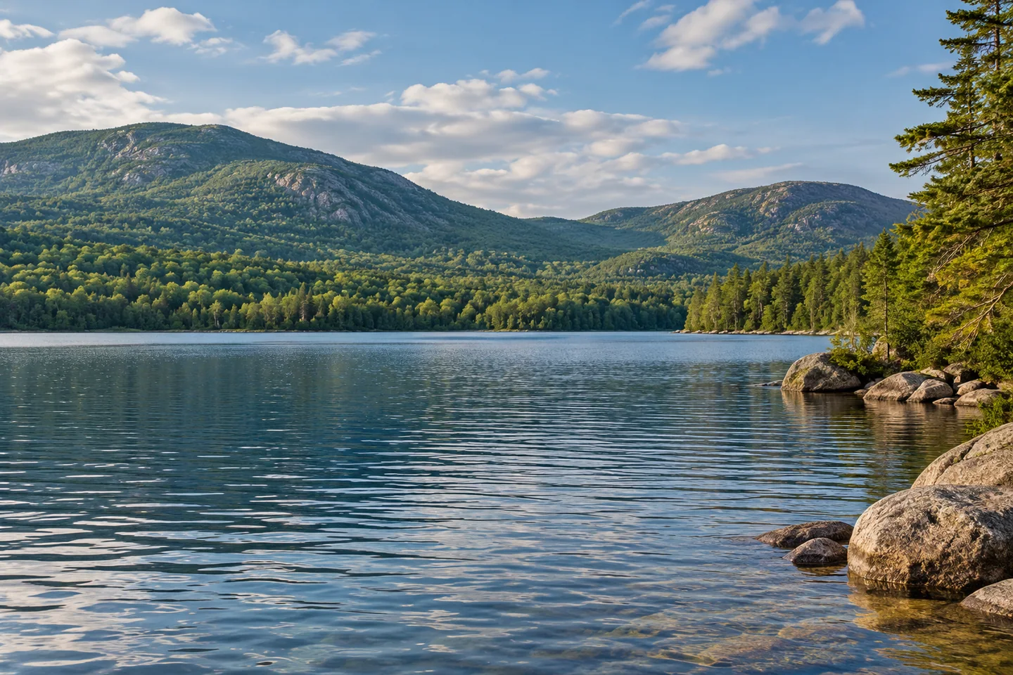
Eagle Lake offers a freshwater boating perspective on Acadia's mountain landscape from a public ramp off Route 233. The National Park Service's current access description shows how closely boating and carriage-road use meet here: cyclists and pedestrians pass through gates while boats approach the water on a small slope. Keep those routes and the launch clear. The lake's protection rules also shape the outing, with swimming, surfing and pets in the water prohibited. A visit can begin by reading the interpretation at the access before deciding how far to paddle, rather than treating it only as a convenient parking place.
The relationship with Bar Harbor is older than the national park. The town's 2005 water-system master plan traces the private Bar Harbor Water Company's incorporation to 1874 and the town's takeover to 2001. It records an earthen dam built by the water company in 1895 and explains that Eagle Lake receives water from Bubble Pond and the surrounding park watershed. Those details place the view within a functioning community system. The same water that gives a paddler room to look toward the hills has long supported people beyond the shore. The master plan also explains that the lakeshore treatment building originally served as an intake screen house, another layer in the infrastructure’s changing story. Keep clear of intake infrastructure and observe its role without approaching operating structures.
The state's fisheries survey, revised in 1999, tells a specific story about lake trout. Increasing numbers of unmarked wild fish in anglers' catches led to the end of lake-trout stocking in 1994. The report distinguishes that self-sustaining component from other fisheries more dependent on hatchery fish. It also explains that lake trout consume smelt, limiting how many salmon could be stocked. These are historical management findings, not a current stocking schedule or catch forecast. They make the clear-looking surface more interesting by pointing toward feeding relationships and reproduction that cannot be judged from the attractiveness of a shoreline photograph.
A GeoMeandering account published in January 2021 describes an October kayak outing that gave its travelers a different perspective from cycling the surrounding carriage roads. From the water, mountain slopes that trees had partly screened became a broad view. The paddlers noticed rocks beneath the surface and kept away from buoys marking water-supply infrastructure. They also recalled two eagles perched above the opposite shore. Those observations belong to that outing and do not promise wildlife or perfectly clear conditions on another day. The account's return was helped by a tailwind, a reminder that the direction of travel is part of the experience rather than an incidental detail.
For a photograph, try leaving a substantial band of water below the mountain skyline so the image explains the scale of the outing. Take a second frame that concentrates on a nearer shore detail from the same stable position. The two views can show how the place changes with attention, without requiring a more distant objective or a closer approach to wildlife. Stop handling the camera before resuming boat maneuvers.
Fun facts
- The town’s water-system history records a dam built by the water company in 1895.
- A historical survey records lake-trout stocking ending in 1994 as wild fish became more prominent.
Before you go
- Keep the boat launch and carriage-road access clear for their respective users.
- Do not swim or put pets in Eagle Lake’s water.
Visitor perspectives
- The GeoMeandering writer enjoyed broader mountain views from a kayak than from the carriage roads, recalling submerged rocks, a tailwind return and two eagles above the shore.
Capture
- From a stable position, leave a band of water below the mountain skyline, then make a second frame of a nearer shore detail.
 Grand State of Maine — Maine Tribute Moose
 Long Pond on Mount Desert Island
 Seal Cove Pond
Social
Eagle Lake’s public ramp is reached from Route 233.
Boating and carriage-road users share a compact access setting.
Swimming and pets in the water are prohibited.
Eagle Lake’s water-supply history predates Acadia National Park.
A historical survey records a shift toward wild lake trout.
Smelt connected the lake’s trout and salmon management story.
One kayak account found mountain views that roadside trees had partly screened.
A wide water-and-mountain frame can tell a different story from a close shore detail. #Cre8Travel
Hashtags