 Cre8Travel
CRE8TRAVEL · MAINE PLACES
Dyer Long Pond
Dyer Long Pond: A Shallow Water Outing with a Longer Story
Discover
Dyer Long Pond in Jefferson has a state-recognized access point for a small-boat outing. The fisheries department's access-point document identifies Dyer Long Pond Access, while a 2025 paddling account describes reaching the western-shore hand-carry landing from Hinks Road. Confirm the present approach before loading equipment, particularly if your party needs an accessible transfer. A public access designation establishes a place to begin checking; it does not tell you the condition of the road, the waterline or the landing on the day you arrive.
The historical fisheries survey describes a shallow warmwater setting, with a maximum depth of 16 feet. Its account of smallmouth and largemouth bass reflects management knowledge at the time of the report's 1996 revision, rather than a current catch prediction. It also records sea-run alewives using the pond to spawn and calls for adequate passage at the outlet dam. That relationship makes the water more than an isolated inland basin. What happens at an outlet can matter to fish whose lives extend beyond the scene visible from a boat.
Water levels have also required public decisions. The Board of Environmental Protection's report covering 2022 records a March 2020 order establishing a water-level regime and minimum flows for Dyer Long Pond. It says an appeal was withdrawn in January 2022 following alternative dispute resolution. This gives firmer historical context than treating an old complaint as an indefinitely unresolved situation. It does not establish today's measured water level or compliance. For a visitor, the useful distinction is between knowing that management exists and finding out what conditions actually permit at the launch.
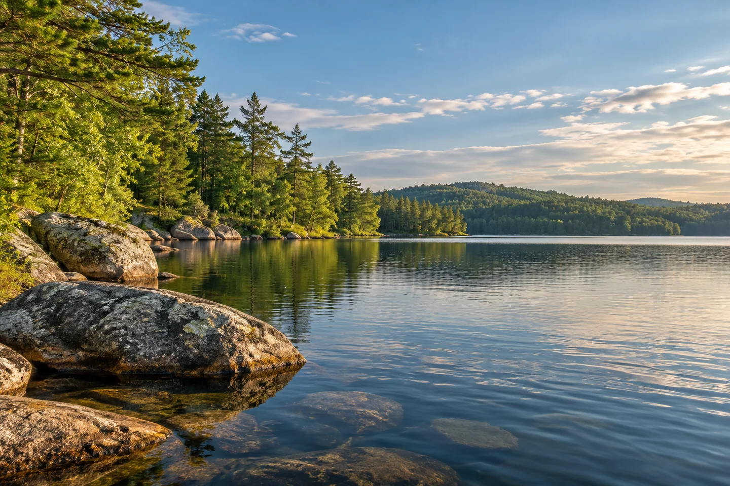
John Christie's July 2012 column presents the pond as a place he liked revisiting early or late in the day. He especially noticed granite boulders around the shoreline and warned that some rocks were just below the surface. His account makes the shore worth studying without making it a smooth or obstruction-free route. Read his pleasure in quiet water as a personal experience, and let actual wind and visibility guide your own outing. The boulders can supply a clear photographic subject from a secure position without becoming places to scramble out of a boat.
Ron Chase returned with companions in July 2025 and described a different thread of exploration. In the north they entered a narrow brook among lily pads and dense vegetation, eventually deciding they had gone far enough. Elsewhere he noticed a colorful invasive plant, purple loosestrife, complicating the idea that every attractive flower indicates a healthy wetland. The group returned to the public landing for lunch during the outing. His story suggests an adaptable day built from shorter investigations, rather than a requirement to force every inlet or reach a fixed distant goal.
Try pairing one broad photograph of a shore bend with a closer frame that describes a rock's relationship to the water surface. Keep the boat stable and the camera work brief. The two images can preserve a useful distinction between the landscape you admired and the details that affected how you moved through it.
Fun facts
- The historical fish survey records a maximum depth of 16 feet.
- A state board report records a water-level order in 2020 and withdrawal of an appeal in 2022.
Before you go
- Confirm the current hand-carry approach and transfer conditions before bringing equipment.
- Watch for shallow rocks and let present conditions set the outing’s extent.
Visitor perspectives
- John Christie described enjoying repeated visits early or late in the day and drew attention to shoreline granite boulders and rocks just below the surface.
- Ron Chase’s group explored a northern inlet and turned back in dense vegetation during a July 2025 outing, stopping at the public landing for lunch.
Capture
- From a stable position, pair a broad shore-bend image with a closer frame of a boulder against the water surface.
 Silver Lake in Bucksport
 Trues Pond
 Crystal Pond and Nelson-Butterfield Park
Social
A state access document identifies Dyer Long Pond Access in Jefferson.
Confirm the condition of the hand-carry approach before moving equipment.
The historical survey describes a shallow warmwater pond.
Its fish history includes sea-run alewife spawning.
A water-level order and a later appeal withdrawal appear in the state board’s record.
One longtime visitor paid particular attention to granite boulders.
A 2025 group adapted its exploration to dense inlet vegetation.
A broad shoreline frame and a rock detail can tell different parts of one outing. #Cre8Travel
Hashtags