 Cre8Travel
CRE8TRAVEL · MAINE PLACES
Concord Pond
Concord Pond: A Shallow Lake beneath Woodstock’s Hills
Discover
Concord Pond in Woodstock, also recorded as Big Concord Pond, is a separate destination from the smaller mountain pond called Little Concord. Plan for a waterside outing here rather than following the hiking approach to its namesake. Maine KayakGirl's 2016 account describes a rustic hand-carry entry from Concord Pond Road, with a steep bank that made retrieving her kayak a serious consideration. Inspect the authorized entry before unloading, and decide whether carrying your craft back out will be manageable. A route that works for another visitor may not suit your equipment or mobility.
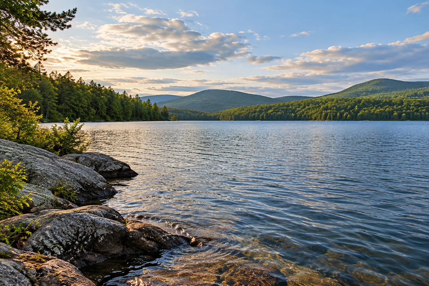
The same visitor found a setting that combined surrounding hills with plenty of human activity. Canoes, kayaks, a paddleboard, and a sailboat shared the water during her outing. Ledges descending into the pond were a favorite feature, and she photographed an eagle after watching it settle in a tree. Those are observations from one summer visit, rather than predictions for yours. The account is particularly useful for resisting the assumption that a small pond surrounded by hills must always offer an isolated wilderness experience.
The historical state fisheries survey explains a less visible characteristic: Big Concord is shallow, with a recorded maximum depth of twelve feet. Its biological discussion centers on warmwater species, including smallmouth bass, chain pickerel, and white perch. Young perch are described as both competitors and a food supply for larger predators. That relationship makes the list of fish more interesting than a checklist of potential catches. The survey was revised in 1991, so its population assessments and experimental trout stocking belong to fisheries history, not a promise about what anglers will find today.
The view also has a documented energy-development history. In its 2010 Spruce Mountain Wind Project decision, Maine's environmental agency discussed the appearance of turbines from Concord Pond and noted homes and camps along the shore. Residents had asked why this pond's scenery was treated differently from certain nearby lakes. The decision explained the classification used in that review; it was a regulatory distinction, not a judgment about whether a visitor should enjoy the pond. KayakGirl later recorded the turbines in her 2016 view, bringing that planning history into an ordinary recreational outing.
There is a connection between the hills and the water beyond what appears in a photograph. The project's environmental review identified parts of the development within the Big Concord and Shagg Pond watersheds and required treatment of runoff to address phosphorus. Consider that as background to the scene, rather than an invitation to enter the wind facility or a claim about current water quality. A pond is affected by activity on the land draining toward it, including places outside the immediate shoreline frame. The surrounding slopes are part of the water's context.
Choose a modest route that leaves enough energy for the carry out and enough time to navigate the roads before dark. Keep private yards and docks outside your landing plan, and give other craft space at the return point. For photographs, consider one broad view that includes the actual landscape and another closer study of water against rock, taken from a secure position. There is no need to remove every sign of people from the story. Concord Pond offers an opportunity to notice how recreation, aquatic habitat, homes, and energy infrastructure occupy the same landscape.
Fun facts
- Big Concord Pond is distinct from Little Concord Pond in Woodstock.
- The historical fisheries survey records a maximum depth of twelve feet.
- Concord Pond featured in the scenic review of the Spruce Mountain Wind Project.
Before you go
- Inspect the authorized hand-carry entry and plan for lifting your craft out again.
- Keep private yards and docks outside your landing plan.
- Carry backup navigation and leave a comfortable margin for the drive out.
Visitor perspectives
- Maine KayakGirl’s 2016 account enjoyed Concord Pond’s surrounding hills and rocky shore, while finding the water busy with several kinds of craft. She also emphasized the challenge of carrying a kayak back up the launch bank.
Capture
- Include the actual hill and shore setting in a broad composition from a lawful position.
- Study the meeting of rock and water without approaching wildlife or using private shore for a foreground.
 Sand Pond
 Elizabeth Perkins House Museum
 Lady Pepperell House Museum
Social
Big Concord Pond and Little Concord Pond are different Woodstock destinations.
A historical fisheries survey describes a shallow warmwater habitat.
White perch can compete with predators while also providing food for them.
The surrounding hills are part of the watershed as well as the view.
Concord Pond appeared in the Spruce Mountain wind project’s scenic review.
Maine KayakGirl’s 2016 visit combined hill scenery with an active recreational pond.
Plan the carry out before committing to the launch.
What belongs in your lake photograph: only water and hills, or the fuller landscape around them?
Hashtags