 Cre8Travel
CRE8TRAVEL · MAINE PLACES
Wyman Lake
Wyman Lake: A River Valley Shaped by Water and Work
Discover
Wyman Lake is a long reach of the Kennebec River shaped by a hydroelectric dam, with a history that combines power generation, timber transport and recreation. The state’s fisheries survey dates its formation to 1930 and describes roughly fifteen miles of impounded river. It also records how log driving and stored pulpwood once influenced use of the water. That background gives a lake outing a distinctive setting: this is scenery shaped by both a river valley and an industrial history.
For an ordinary public visit, Bingham’s recreation planning document identifies a launch and swimming area in Pleasant Ridge Plantation and another boat launch in Moscow. Those separate approaches offer choices for the scale of an outing. Decide whether you want time at the public shoreline or a properly equipped trip on the water, then check the specific access arrangements. A large lake does not require a long journey to provide a satisfying encounter with its setting.
A Bullfrog Adventures route description follows the valley northward and uses the direction of the wind in deciding how to travel. It also points to Carrying Place Stream, associated with Benedict Arnold’s 1775 expedition leaving the Kennebec for the overland connection toward the Dead River. Read the guide’s description as a perspective on the landscape, rather than a promise that a particular commercial trip is currently offered. It suggests how water travel can bring geography and history into the same view.
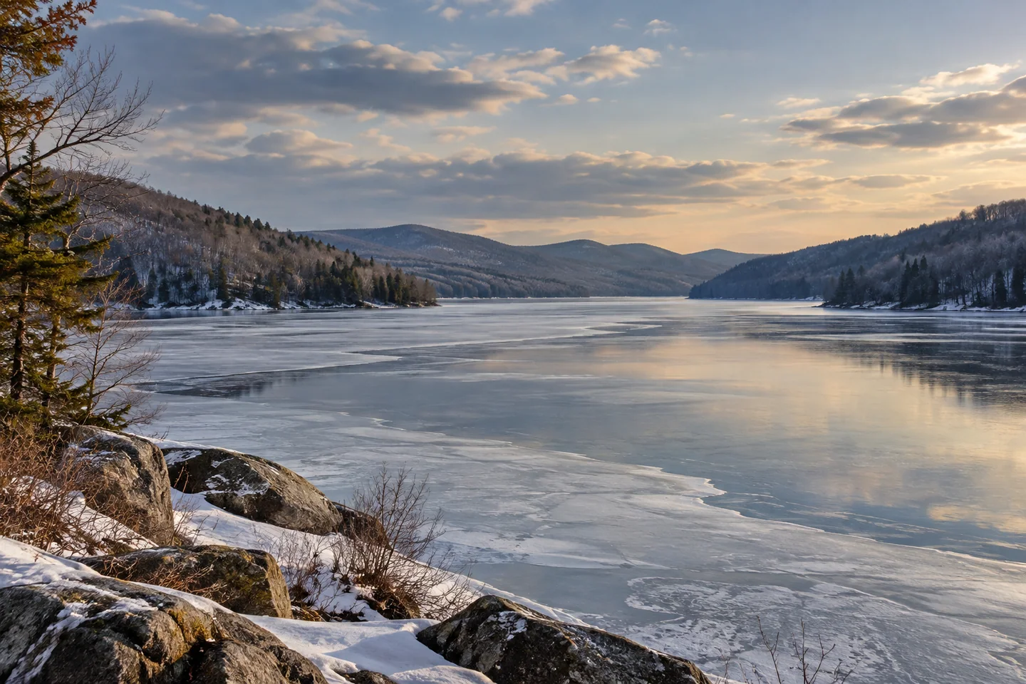
Jay Gaulard’s April 2020 account provides a contrasting visit from shore. Expecting open water after watching a friend’s camping video, he arrived to find the lake still frozen. He photographed the view from the boat ramp near Pleasant Ridge’s swimming area and made a panoramic lake image. The useful lesson in his recollection is the gap between an imagined season and what is actually present on arrival. His photographs and response belong to that particular outing.
The fisheries survey offers another surprising perspective below the surface. It describes a relatively deep boundary between warmer upper water and cooler water beneath, influenced by the power intake and the inflowing Kennebec. The resulting coldwater habitat is part of a larger system of moving water, rather than simply a still basin. Knowing that relationship can add depth to the experience of looking along the lake: the same river that defines its shape also continues to influence its underwater conditions.
Because the hydroelectric facility remains part of the setting, consult Brookfield’s current Wyman flow information before a water outing and follow posted restrictions around dam infrastructure. Forecast schedules can change. Build the visit around a public access site and conditions suitable for your group, allowing the working river to remain part of the planning rather than treating the lake as separate from its power-generation role.
For a quiet shore visit, give the long valley view time to register. Look at the way successive points interrupt the water’s outline and how the view changes as light moves across it. The pleasure can be in that slow observation, alongside a better understanding of why this particular lake exists and how people continue to use it.
Fun facts
- The state survey dates formation of Wyman Lake to 1930.
- Public lake access is identified in both Pleasant Ridge and Moscow.
Before you go
- Check current Wyman facility information and follow all posted exclusion areas.
- Confirm your chosen public access site before planning a water outing.
Visitor perspectives
- Jay Gaulard expected open water but found Wyman Lake frozen during an April 2020 visit, enjoying shore views and making lake photographs instead.
Capture
- From a public shoreline position, try a wide study of the lake’s valley setting.
- Make a sequence of shore views rather than stepping onto uncertain ice.
 Embden Pond
 Moxie Pond
 Indian Pond
Social
Wyman Lake carries the history of an impounded Kennebec River valley.
Pleasant Ridge and Moscow provide different public approaches to the lake.
Water travel can connect a valley’s geography with its human history.
Gaulard’s 2020 visit found ice where he had imagined open water.
The inflowing river helps shape the lake’s underwater conditions.
Current facility information belongs in a plan for this working-water landscape.
A lake visit can be a pause at the shore, not a distance to complete.
Let changing light reveal the shape of a long valley view.
Hashtags