 Cre8Travel
CRE8TRAVEL · MAINE PLACES
Pushaw Lake
Pushaw Lake: Islands, Wetlands and Lakeside Life
Discover
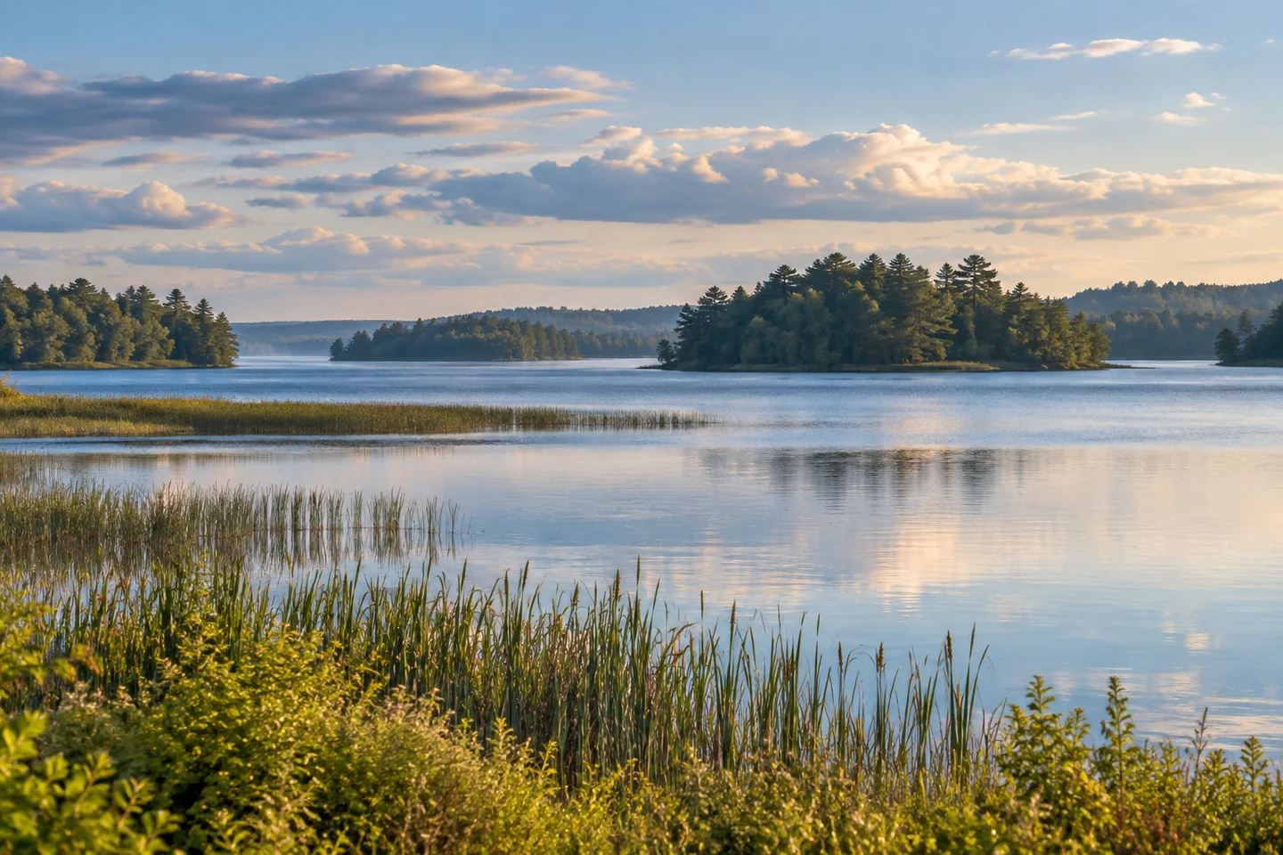
Pushaw Lake is a reminder that a Maine lake does not have to be far from everyday life to deserve a proper day on the water. Shared by Glenburn, Hudson, Old Town and Orono, it has islands, broad reaches and a long-established shoreline community. Its shallow water and wet margins give it a different character from a steep-sided mountain pond. Plan to explore a manageable part of the lake rather than turning the whole outline on a map into an obligation.
Start with an actual public launch. Glenburn identifies Lakeside Landing as town-owned waterfront with a boat launch. Confirm the appropriate town's parking and use arrangements before setting out, particularly when arriving with a trailer. These approaches let the water be the principal outing; Gould Landing's separate woodland walk is another experience, rather than a required starting point for every visitor to Pushaw.
A map makes the islands part of the pleasure. The federal topographic sheet identifies Dollar, Moose and the island labeled Hardwood, among other features. Looking between them can reveal how much a wooded outline changes as one position overlaps another. That is a good reason to carry a chart even on an unambitious trip. It is also a reason to resist treating islands as automatic picnic stops: a mapped landform does not establish a right to land there.
Jeff Strout's April 2006 Bangor Daily News column follows a personal circuit among several southern islands. He appreciated spring sunshine, encountered small waves and heard frogs near a wetland shore. At one potential stop the wind was pushing waves onto the beach, so he kept moving. His account brings the lake to life through decisions and small observations, rather than a checklist of destinations. The conditions and stops describe his historical outing, not a prescribed route or a promise about today's access.
Pushaw also has a substantial human landscape. The Greater Pushaw Lake Association represents year-round and seasonal residents across thirteen lakeside neighborhoods. Its history resources point to Winifred Collins's locally researched historical profile and collections of earlier photographs and memories. A distant line of camps is therefore more than background scenery. It is part of a place people have documented, returned to and worked to protect over generations. Enjoy that visible continuity without photographing private homes as if they were public exhibits.
Water stewardship is especially relevant here. The association explains why it takes invasive aquatic plants seriously and describes launch inspections as one protective measure. Cooperate with any current inspection and check your boat and equipment before transferring between waters. A clean launch is a practical contribution to a place shared by swimmers, anglers, paddlers and shoreline residents. Let the wetland margins remain habitat, and observe birds without crowding them into flight.
For photographs, try overlapping island silhouettes, then a quieter composition of reeds and open water from a permitted position. Keep the camera secondary while navigating. Wear a life jacket, prepare for cold water and set a route that leaves room to turn around when wind builds. Pushaw's appeal is the combination of an expansive lake and close attention: a familiar-looking shoreline becomes more interesting when the islands, community history and changing water all have a place in the day.
Fun facts
- Pushaw Lake is shared by Glenburn, Hudson, Old Town and Orono.
- Glenburn operates Lakeside Landing on the lake.
- Federal mapping identifies Dollar and Moose islands.
Before you go
- Confirm town-specific parking and launch arrangements before bringing a trailer.
- Carry a current water map; do not assume mapped islands allow public landings.
- Cooperate with boat inspections and remove aquatic material before changing lakes.
- Choose an achievable return route when wind is building.
Visitor perspectives
- In an April 2006 Bangor Daily News paddling column, Jeff Strout enjoyed Pushaw’s southern islands and spring wildlife sounds, adjusting his stops when wind drove waves ashore.
Capture
- Use overlapping wooded islands to give the wide lake several layers.
- From a permitted position, contrast wetland vegetation with a band of open water.
 Cold Stream Pond
 Millinocket Lake
 Upper Shin Pond
Social
Pushaw Lake belongs to the landscape of four Maine towns: Glenburn, Hudson, Old Town and Orono.
Plan the water outing from a verified public launch, with the town’s parking arrangements checked first.
Dollar and Moose islands give a map-reading theme to a paddle. Public landing rights are a separate question.
A shallow lake with wet margins has a different personality from a mountain pond.
A historical paddler’s account describes spring sounds and changing waves around the islands.
The lake association’s historical resources add people and memories to the shoreline view.
Clean equipment between waters and cooperate with launch inspections.
Which catches your attention first: overlapping islands, wetland textures or the life along the shore?
Hashtags