 Cre8Travel
CRE8TRAVEL · MAINE PLACES
Noble Hill Preserve
Noble Hill: Fields and River Views in Phippsburg
Discover
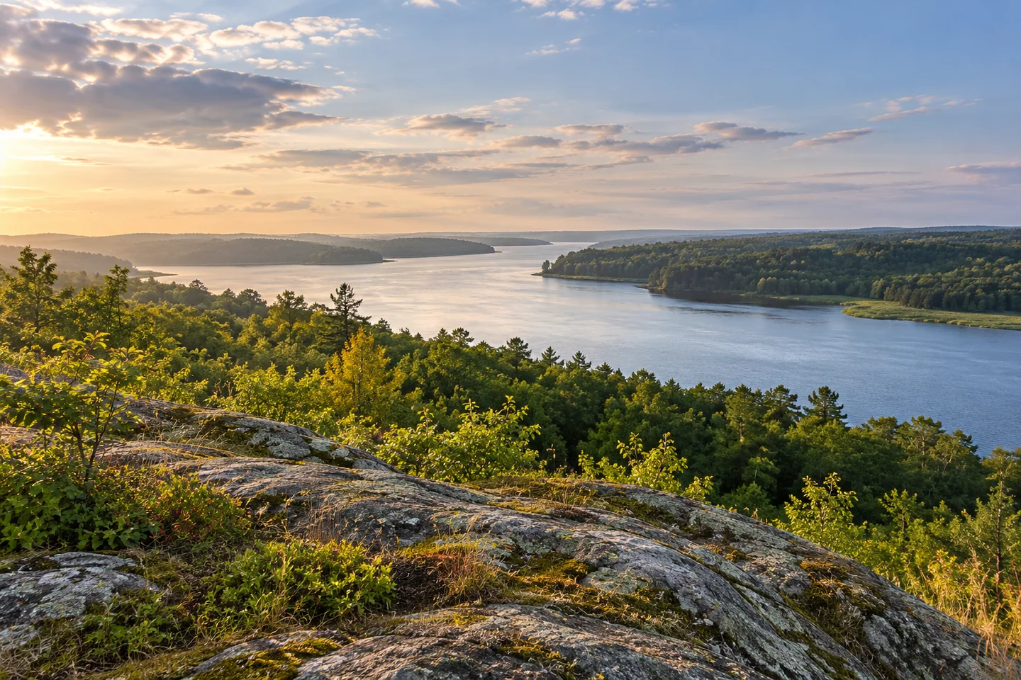
Noble Hill Preserve brings woodland, open fields, and Kennebec River views into a compact Phippsburg outing. Phippsburg Land Trust welcomes the public during daylight hours. Its description highlights a gift from the Cunningham family, with ledges overlooking the river and a second outlook toward a small salt marsh. Let those different settings organize your walk: a field's openness, a shaded stretch, and the point where the water becomes visible.
Use the trust's directions for parking on Fiddlers Reach Road. Fort Noble access follows an authorized footpath beside a working farm; remain on that path and respect neighboring land.
Maine Land Trust Network places the preserve within a longer story of settlement along the river. Its history account identifies the remains of a fort built in 1734 and part of the Noble and Lithgow farm. The fort's position allowed people to watch approaches from either direction along the Kennebec. A view appreciated today for its beauty once also mattered for surveillance and defense.
Phippsburg's 2006 comprehensive plan records Fort Noble's remains at Fiddler's Reach among the town's archaeological resources. It also notes Colonel Noble's house on John North's 1751 map, with a later church reported at that location. Those references suggest a landscape whose uses and buildings changed over time. Treat the mapped house history as background, rather than expecting an intact dwelling beside the trail. Surviving ground features and documents preserve different kinds of evidence, and each can help explain what the other leaves uncertain.
An original Maine Trail Finder contributor, posting in November 2019, found the walk pretty and enjoyed views of the Kennebec. The writer recalled mostly meadow surroundings and generally comfortable footing, with some muddy places. It is a modest account of one visit, but its scale suits this destination. Instead of expecting a long expedition, consider how the contrast between open ground and a river outlook can give a short walk enough variety.
A Phippsburg Elementary School report describes younger children visiting Noble Hill with teachers and family helpers. The shared photographs recorded outdoor exploration, and the group paused for water, a snack, and a story. That original school account provides another way to think about a preserve visit. Looking, talking, and resting can each be part of the outing, rather than activities squeezed between walking from one end to another.
The town's archaeological inventory places Noble's house and fort among evidence of a community organized around waterways. It also records corn mills on Parker's Bay and a dam and mill at Dromore, using early maps alongside visible remains. At Noble Hill, that wider context can sharpen a simple question: how did access to water serve work, settlement, and defense in different ways? The river outlook becomes a starting point for understanding the region's older connections.
The trust describes more than a quarter mile of Kennebec shoreline and vernal pools that become especially lively in spring. High ledges on the eastern side and the southern salt-marsh outlook offer distinct perspectives. Choose a route that includes those differences, allowing the preserve's mix of small seasonal waters and a much larger river to give the walk its shape.
Before you go
- Use the official gravel parking area and remain on the authorized farm-side Fort Noble footpath.
- Expect conditions to vary; an individual visitor reported some muddy areas.
Visitor perspectives
- The contributor enjoyed the meadows and Kennebec views, while noting some muddy spots.
- The school reported an outdoor visit by Pre-K and kindergarten pupils, including a snack and story.
Capture
- Let the river outlook help explain why the historic site’s position mattered.
- Compare a close foreground with the wider scene without disturbing either.
 Sheep Island Preserve
 Sandy Beach Park
 Rockport Marine Park
Social
Noble Hill combines open fields, woodland, and Kennebec River views.
Fort Noble’s river outlook once served a defensive purpose.
Historic maps and surviving ground features preserve different evidence.
One walker remembers meadows and a rewarding river view.
A school outing left time for a snack and a story.
A short walk can leave more space for conversation.
Take one question into the landscape and see where it leads.
An outing’s value need not depend on its length.
Hashtags